IN 711‚ when other Moslem forces were invading distant Spain, Arab soldiers fought their way to the mouth of the Indus River and captured the area called Sind. There they stopped. Nearly three centuries passed before Moslems again menaced India. In 998, a Turk named Mahmud, the amir of Ghazni in Afghanistan, burst through the Khyber Pass with an army of Turkish horsemen to sweep across the Punjab in the first of seventeen raids. Not even the savage, pagan Huns had been as bloodthirsty as these civilized sons of Islam. They hated the Hindus with a special hate. Believing in one God and in the equality of all men, they abominated the Indians for their countless gods and idols and their caste system. In a frenzy of righteousness they slew thousands upon thousands of Indians, smashing their temples and demolishing their cities. The Hindus fought back bravely, but their slow-footed elephants could not keep up with the Turks’ fast horses. They were hindered, too, by the custom which decreed that only members of the warrior caste could fight. Sometimes, when the Hindu defenders of a stronghold saw that the end was near, they carried out a dreadful rite called jauhur. They placed their wives and children on top of a huge pile of wood and set fire to it. Then, as their families were burned alive, they marched forth from the gates, carrying their swords, to meet certain death. The fearful raids of Mahmud “the imagebreaker” were followed by a large-scale Moslem invasion toward the end of the next century. In 1191, Mohammed Ghori, an Afghan not only raided India but occupied it. By destroying Buddhist universities and massacring their priests, he wiped out Buddhism in the land where it began. Soon he controlled most of the north. When a …
Read More »India: A Thousand Years of History A. D. 1 – 710
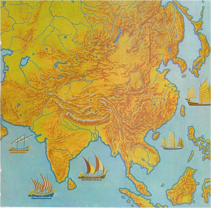
UNTIL 1947, when the Moslem state of Pakistan was carved out of its western and eastern corners, the entire triangle of land that points south from the Himalaya Mountains into the Indian Ocean was known as India. Geographers call this huge land mass a subcontinent, because it is almost completely cut off from the rest of the continent of Asia. The Himalayas on its northern frontier form a continuous barrier of rock, the highest in the world. “MOTHER GANGES” From the southern slopes of the Himalayas, two great rivers run down to the ocean. The valley of the Indus River, on the west, is mainly desert; overlooking it are the only breaks in the Himalayan wall, the Khyber Pass and the Bolan Pass. The valley of the Ganges River, on the east, is a broad, fertile plain. Indians consider this river holy and call it “Mother Ganges.” Together, the Indus and Ganges Valleys make up North India. South of the Ganges Plain rise the Vindhya Mountains. To the south stretches a very large region of hilly uplands, called the Deccan. At its western and eastern edges the Deccan drops suddenly to coastal plains, forming long mountain walls called Ghats. The Vindhyas, the Deccan, the Ghats and the strips of lowland along the coasts make up South India. INVADERS FROM THE NORTH Geography influences history. This is particularly true of India — so much so, in fact, that North and South India have really had two separate histories. From earliest times, the people in both parts of the country were mostly poor farmers, living in villages. They shared the beliefs of the Hindu religion. Hinduism taught them that life was only a dream, they paid little attention, north or south, to the events that took place in their lifetimes. Otherwise, however, …
Read More »

